

Road Conditions - California
View in App StoreGrow your in-app revenue
while we take care of your subscription management.
Mobile
SDK by Qonversion.
Price Intelligence based on:
213,534
apps aggregated
8,172,290
in-app prices defined
89
main categories
In-App Purchase Price (Subscription or Non-Recurring)
vs. average for the Navigation category, $, by region
Build, analyze, and grow in-app subscriptions
with the most powerful mobile SDK for subscriptions
User Reviews for Road Conditions - California
Best CHP App
Finally an app comes out that is better than Caltrans and the other paid CHP app. Works well. The CHP CAD site is too difficult to navigate while on the road this is the best version
Perfect App for Skiers
This app makes it so easy to check all the road conditions before and as you head up to ski. I love it so much.
Awesomely Handy App
I love this app and it will come in a lot of handy for my road trips.My first suggestion would be to add a toggle switch to turn closed road lines on or off. Currently, the only way to see which stretch of a road is closed is to zoom really far in, until a line appears over the road.I would love to see these stretches of closed roads when zoomed further out, like the whole state, to easily see what is closed. I would also make it red.It would also be awesome, for those who allow location services, to receive alerts for roads that just closed near you. So, one could set a radius of say 10, 25, 50, and 100 miles for when new road closures go into effect. This would be especially helpful because sometimes when driving to/through a snowy destination, the roads can close quickly. Assuming this app pulls info from CalTrans servers relatively fast, it would be awesome to get almost real time alerts if a road near you just closed, as it may be blocking your intended route.
Extremely useful
I have been using this app since it first came out a few years ago and still use it to manage my commute between SoCal and the Central Coast. It has been an absolute godsend! The app isn’t designed to be overly intelligent, but it does an amazing job of aggregating data from many different sources. Keep in mind, the data is only as reliable as the source it’s pulling from. Fortunately, the jurisdictions I travel through seem to keep their data updated in a timely manner.
Needs updating, great potential
Seems like this app could use a bit of updating. For example, subscribing to alerts takes too long and a lot of the time it doesn't even subscribe (app freezes). Also, everytime you open the app it resets the view. It would be better if the view was zoomed into where it was last location. Finally, it would be great to be able to set up notifications to come up along your commute (I would pay for this feature).
Very handy
Love the camera feature. The map is great with all the various alerts arr excellent. Only thing I found was a legend (but figured it out eventually).
The App we needed but don’t deserve
Honestly amazing. Very full feature and easy to navigate. As an avid winter camper in the Sierras I’ve been looking for something like this for years. Very well done - thank you!
Solid 🤙🏼
Awesome plat form and effort! You can tell all the bases and information avenues here for traffic and commuting are covered. I actually can’t wait to try on a regular city day to see if it’s helpful.
Very nice experience
This app is a great replacement for the base caltrans app which is clunky and very difficult to use. before I had to use cal trans because it was the only easy way to get the data without going to the website but now this app blows it away. The camera groupings is an especially nice touch to reduce clutter. Only improvement would be to add the green/yellow/red traffic speed lines right on the map.
So easy to use and very informative
Wow, an app that actually helps me instantly see road conditions, along with camera views of the freeways, all in an easy to use interface. Thank you for a great app, I will be using it daily for my commute to LA. Bravo!
Description
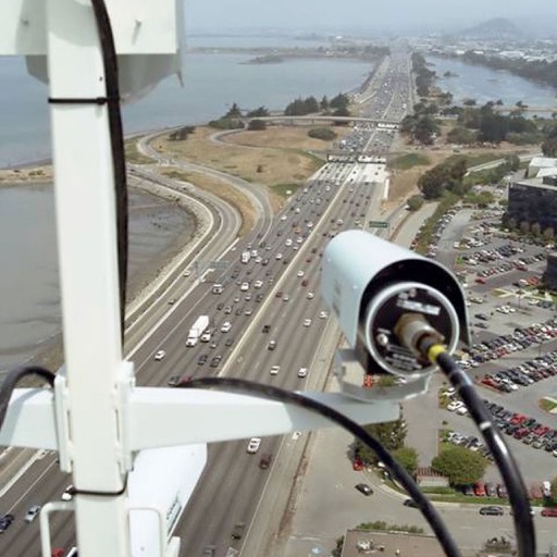
The best way to view Caltrans & California Highway Patrol (CHP) information. California Highway Patrol Incidents: + Traffic collisions, advisories, hazards + Weather / wind advisory + Wrong way driver + Road closure + Wrong way driver + Chain control + Animal hazard + Fire .. and all other CHP incident types Caltrans Road Condition Information: + Full road closure + Lane closure + Rest area closure + On / off ramp closure + Message signs + Chain control signs CCTV Cameras Create customized groups of CCTV cameras for viewing traffic on your route.
More By This Developer


You May Also Like


POWER SUBSCRIPTION REVENUE GROWTH
