Click on traffic camera icons to see a camera image. Click on a CHP, lane closure, changeable message sign or chain control icon to view details for that marker. Traffic data is updated every few minutes. Load the latest data on the map using the Refresh button. If you choose to enable Geotargeted Notifications, this app will monitor your location in the background and alert you (via a Push Notification) to State Highway System road closures occurring near you. Continued use of background location may decrease battery life. Something not right with the data displayed on the map? Please send us an email to [email protected] rather that letting us know with a low-rated review.

Caltrans QuickMap
View in App StoreGrow your in-app revenue
while we take care of your subscription management.
Mobile
SDK by Qonversion.
Price Intelligence based on:
213,534
apps aggregated
8,172,290
in-app prices defined
89
main categories
In-App Purchase Price (Subscription or Non-Recurring)
vs. average for the Navigation category, $, by region
Build, analyze, and grow in-app subscriptions
with the most powerful mobile SDK for subscriptions
User Reviews for Caltrans QuickMap
Very good App
I use this app for general information on CHP incidents and road conditions. Chain control info and location of snow plows in real time is very useful, as is the sign information. I have had no issues running this on my iPhone 11.
Lives up to the CalTrans reputation
I tried this app on a trip up 395. To my surprise it had the route closed due to weather, last updated 5 minutes ago! It was a 90 minute trip to the closure… But knowing a little about the CalTrans reputation, I decided to drive it to verify the closure rather than scrap my vacation. Turned out the “Road Closure” was a sign that suggested motorists carry chains with them. Had a great vacation. Deleted the app.
Poor substitute for San Diego Real Time Traffic map!
The SDRTT map gives/gave you the colors, but also the real time data from the freeway sensors. Red is slow - so do you want the 10 mph slow route or the 2 mph slow route? You'll never know which is which with this app. This has many details, like each ramp and transition, but if it's backed up you don't have to zoom to the ramp to know it's clogged.The SDRTT map had/has a link to the current CHP activity in chronological order, so you could easily see what events were affecting your drive now without having to click on all of the events. Don't make the state maps like Google, make them like the SDRTT map! Give us more info, not less!
Good traffic app with room for improvement
I use this app almost daily for planning a variety of commutes off the mountain from Big Bear and find the information provided to be reasonably accurate. It's especially handy when you need to know if you will encounter chain control stations before you start out on your mountain journey through stormy weather. I really appreciate no ads! For improvements, the "Warning" users have to click when the app opens is an unnecessary annoyance and should be removed - put it in a terms of use agreement to make your lawyers and app users happy. I would also like the app to be able to store my customized map regions rather than make me use screen gestures to draw the map zoom level every time I load the app to see my entire commute through multiple counties - It's not really helpful to select a county and still have to resize the screen. Let me create the Zoom level in a particular map location and then save that view in a memory with a custom name as is common in weather map apps. Speaking of weather, probably asking way too much, but I've thought many times that a weather radar layer would be handy on this traffic map app. Maybe you could team up with the ACME team at "My Radar".
Ok but
Not as useful as the old San Diego real time traffic report which was excellent. This version actually manages to give less information than the RTTR which you could zoom into a single freeway and get a list of actual freeway speeds. This gives you 4 colors instead and doesn’t tell what they mean. You have to guess what red means and exactly where the threshold between red and orange might lie likewise or age to green. Wow! high resolution: 3 bands and some other 4th unknown one. Versus mph list, no contest. However it is a pretty map, albeit lacking in info vs the old one, so if they add some definition of the colors without me having to google for them plus bring back the old speed list view as an overlay somehow then I’ll give it a five.
Helpful app, but seems to be lacking an important feature…
This is a great app for checking road conditions in your area or along rural routes when traveling on vacation. It even allows you to view traffic camera views along routes, which is very neat! However there seems to be a very important feature that this app could use and that is having customer service forms integrated into the app. This can already be accessed via web browser but can be difficult to use at a given moment on the road. With that being said, a more user-friendly hazard-reporting interface inside this app will help those traveling the vast road system quickly report maintenance problems etc. and help keep CAs roads clean and functional!
Very useful; need Terrain view
Easier to use than equivalent web page. Need to be able to change base Google Map view to “Terrain” (very helpful in mountainous areas). May as well also allow Satellite, though that’s less useful. The web version allow Terrain and Satellite already.
The good and the bad and the meh
Very helpful that this app shows the locations of roadside rest areas (which information can’t be found on Caltrans web site or Google Maps). But the information on road closures is wildly inaccurate, showing closures that don’t exist and missing those that do exist. This could actually be a danger to people who rely on it for mountain driving. The rest is just repackaged info from Google Maps and Waze, but since Quick Maps has so little accurate and useful info of its own, yours better off getting your traffic and incident info from Google or Waze
Great app but crashing today!
I use this app to navigate all traffic but as of today, it crashes on opening. No updates seen. I hope it gets fixed soon. With all option layers on, this is the most comprehensive app I have found. I wish the fire layer were still active.
SO HELPFUL
QuickMap is an outstanding resource when traveling in the winter. Up to date road closures, chain requirements, camera views, traffic slow-downs...etc. An easy to use but essential travel tool for navigating these winter storms and flooding that have changing conditions every hour.
Description
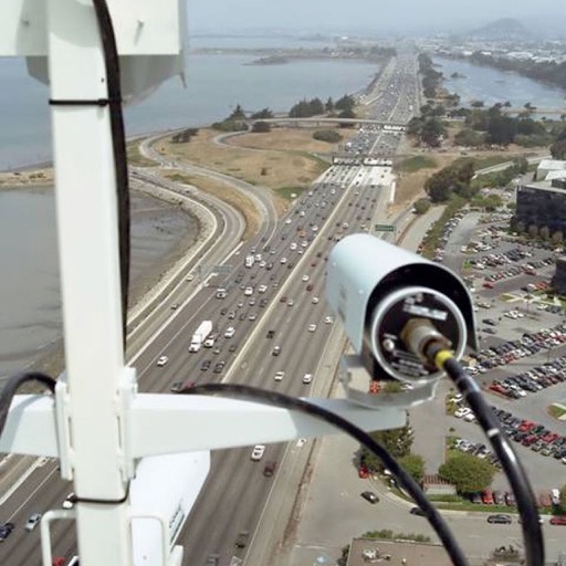
Get your California traffic information directly from the source. The Caltrans QuickMap app displays a map of your location along with real-time traffic information including: - Freeway speed - Traffic camera snapshots - Lane closures - CHP incidents - Highway Information - Changeable message signs - Chain controls - Snow Plows - County Boundaries - Border Wait Times - Safety Roadside Rest Areas - Waze data Set which of these options to display and QuickMap will remember your preferences. Zoom to a view of other parts of California with the Location button.
More By This Developer
You May Also Like


POWER SUBSCRIPTION REVENUE GROWTH
