OFFLINE Download maps for areas of interest to view them later when you don't have Internet access or you don't want to use cell data. TRACKING Use location tracking to show where you are on the map, your elevation, and the accuracy of the GPS signal. FLAGS Flags are included with map downloads. Add flags (waypoints) to the map to mark your current location or other locations. Import flags from other sources using GPX files and geocache LOC files. Share flags with others using email or AirDrop. Organize your flag types by color, for example, geocaches, trailheads, and summits. TRAILS Trails are included with map downloads. Import trails (tracks) using GPX files you find on the Internet or from your personal GPS track collection. Share trails with others using email or AirDrop. Organize your trail types by color, for example, mountain bike trails, hiking trails, and OHV trails. TRAIL RECORDING Record your own trails to show where you've been on the map, follow them later, and share with others. ELEVATION PROFILE Recorded trails include an elevation profile (distance/elevation chart). NAVIGATION Navigate to a flag by following the direction arrow that uses your compass heading. Useful for geocaching. MEASURE Measure the distance between points on the map. Note: Continued use of GPS running in the background can dramatically decrease battery life.

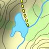
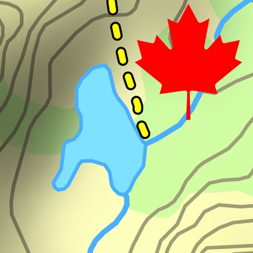
Topo Maps US
View in App StoreGrow your in-app revenue
while we take care of your subscription management.
Mobile
SDK by Qonversion.
Price Intelligence based on:
213,518
apps aggregated
8,172,290
in-app prices defined
89
main categories
In-App Purchase Price (Subscription or Non-Recurring)
vs. average for the Navigation category, $, by region
Build, analyze, and grow in-app subscriptions
with the most powerful mobile SDK for subscriptions
User Reviews for Topo Maps US
So close!
The app runs incredibly well, however i hope there will be a feature added to be able to download maps while at the same time be able to view the ones I have already downloaded. I also hope that there will be a feature to “ select all “ maps a couple of times before staring the download process. Otherwise, I have recommending this to everyone, even when they haven’t even asked lol
USGS and University Approved!!
As a team of geologists from the USGS and a State University who have used this app extensively for field work, this app is officially amazing! Doing field work in the back roads near Yellowstone, this app was invaluable. We used it for navigation, correlation to geologic maps, and even to mark the location of our vehicle before long hikes into the back country. Thoroughly impressed, 5/5. The only thing that would be handy is a data sync option in which you can actively sync waypoints between devices so everyone is on the same page.
A great tool!
So far i am liking this app really well. It took me a bit to figure out some things - like down loading the map squares. But it seems to work well for looking at the map and seeing where you are. One item about this app that i think is killer is the distance drawing facility. One selects the measure option and then draw lines on the map then you see how long that route is. It doesn’t appear to do some other things one might expect, like track you route, but what it does it does well and i prefer that!There seems to be a few bugs: My most compelling issue is that somethings just don’t show up. EI: I wanted to look at Long Island, Willapa Bay Area, but it wasn’t showing up until I changed the zoom level. So I had to down load the squares, then zoom in quite a bit to se the island.One thing that could be improved is the transfer/loading of the tiles. As far as I can tell, one has to do this one tile at a time. Select a group of tiles and download. I commonly forget to download an area, then am in the mountains and off the grid before I remember I don’t have the map.So I spend my evenings selecting 20 or so tiles, downloading them to my phone. I also have a tablet, that I wish just could have the same tiles I downloaded on my phone. And, when you get a new phone, one has to start the processes all over again….
Get it
Great basic navigation app. It has all the features you actually need and, most importantly, it’s simple to use. When you’re out in the field you don’t want a complicated interface with a bunch of social or otherwise needless features. I’ve used it as an NPS backcountry ranger if that counts for anything! I’ve also tried some other more featured and costly apps and this one will suit your purposes, especially if you come from a basic map and compass background.
Good but frustrating
This free app has a lot of great things going for it. But then I get used to all the great things and want more. It drains my battery quickly when I try to record my route. It also suddenly drops routes that I am in the middle of recording. 2-3 miles into a recorded hike, and it will just stop recording and not save the route, even when the phone is plugged into a power brick.It's great for seeing where you are and roughly measuring distances. And it's amazing for being free.
Best offline topo map that I have found
It has the highest level of detail available for free out of any free or affordable apps that I’ve used. It shows every possible trail, steam, wetland, and peak, with very detailed topography. The only downside: it’s missing labels for many trails and geologic features, but it allows you to easily add the names in. With a tiny bit of planning before you leave your house, you can ensure you have a detailed, trustworthy, and 100% free map of your hike.
Excellent app!
This is a really excellent topo app without the silly cloud or social features that seem to be commonplace on nearly all other topo map apps. Thanks developer! I owe you many beers for all the trouble this app has gotten me out of in the mountains. Some of what makes this app great:- Doesn’t require a user account to access the publicly available topo and imagery base maps. Just download before you go, then turn off Map Management to hide the download maps interface. - Allows you to save the maps for offline use which is the cure function all such map apps should have but in reality many others do not. Let’s be realistic, when you’re in the mountains you won’t have cell service and this developer gets it. - Can trace your route, drop flags, and categorize and hide them to reduce map clutter. - Can get your GPS location instantly (new awesome feature, and useful for emergencies)!- Uses little battery when tracing and less when not tracing. I was seeing ~10-15% for a half day of hiking on an iPhone 8. (If you are seeing high battery drain, it’s not this app. It’s probably your other background apps refreshing. Turn off background app refresh for useless apps, or toggle low battery mode to disable it globally and you’ll see that this app uses minimal battery. Also, use airplane mode If you’re not in a service area.)- Map export is reasonably easy: send via email, or bulk export via a simple freeware, no-install WebDAV program.
Get this one first
I use this all the time for for camping, exploring and hiking. Works great. Recording track and waypoints, standard But recently had to put up some signs around town. I used this app to mark each one. Then I used “cyber duck” to connect to the phone/app, and transfer the data to my Mac. Then used “db browser for SQLite” to get the data into excel. It worked pretty well. I’d like to see: what quadrangle I’m in, and be able to download older USGS topo maps. I like using old maps to explore items that for whatever reason have been left off new maps such as petroglyphs, mines, etc. as new development has overtaken it. But this would just bonus and keep me from going into another app. Some other apps have some pretty great bells and whistles (that I use). This app just gets the job done.
Just Amazing!!!
Have used this map for the last 6-7 years backpacking and has been a literal lifesaver multiple times finding my way around!! Placing a flag at your desired location makes it so easy to find your way back. And above all it’s free!!!! The multiple features are astounding. The details are so helpful. Highly recommend without any reservations.
Unbelievable
It is amazing that an app like this is available free of charge. Not only are the maps perfect for hiking, very clear, very readable, but you can flag your hike by importing the location from your photos.It would be plenty just to be able to use and orient yourself with these maps downloaded with the aid of a compass. But, when you add live gps locating, the photo location import feature, throw in the location of popular trails and sights, it better than most portable hiking gps units that cost $400 or more.It’s all you need to navigate. I don’t carry the Earthmate PN 40 anymore. If you’re smart, you’ll save the $400 on buying such a unit and save weight on your hikes.This app should have at least a tipping section because the developer deserves to be paid for it.Consider all the other apps that require a subscription to download maps.This is an awesome achievement,
Description
Download and view topographic maps covering the United States. Topographic maps are useful for recreational activities such as hiking, canoeing, camping, fishing, mountain biking, geocaching, and exploring. MAPS Choose from 2 map sources: USGS standard topographic or USGS hybrid topographic.
More By This Developer

You May Also Like


POWER SUBSCRIPTION REVENUE GROWTH
