
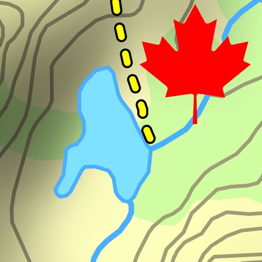
You’ll also have offline access to worldwide 3D map data which limits the drain on the battery and means that you can pre-load a map to store when you don’t have a signal. SEARCHABLE MAPS As an added bonus Maps 3D offers 3D terrain and trip planning, so you’ll never need to worry about getting lost. Towns, streets, mountain peaks and lakes are all searchable, with an accurate and precise map display based on NASA scans of the Earth’s surface combined with the outdoor map OSM (Open Street Map) and the Official USGS topo maps. LOAD YOUR TRIPS & SHARE Trips can be loaded via iTunes, email, URL or Dropbox, and recorded tracks can be shared via email, Facebook and Twitter, great for showing your friends your latest outdoor accomplishments. MORE FEATURES +++ Load a map in advance over WIFI or 4G before your trek, no internet connection needed thereafter +++ Record your routes by GPS, all coordinates and exact elevations are logged +++ Plan and evaluate routes directly in the 3D map view +++ Search for towns, streets , mountain peaks, lakes - offline +++ Distance traveled, current and average speeds all displayed for an ideal trek GENERAL / NOTES Background GPS recording can significantly cut battery life * * * * * If you like Maps 3D, please remember to leave a positive rating on iTunes! The movingworld team is working constantly to improve Maps 3D. Any suggestions? We'd love to hear them! Just e-mail them to us at [email protected]. We'll try to answer you within 24 hours! Thank you for using Maps 3D!

Grow your in-app revenue
while we take care of your subscription management.
Mobile
SDK by Qonversion.
Price Intelligence based on:
213,534
apps aggregated
8,172,290
in-app prices defined
89
main categories
In-App Purchase Price (Subscription or Non-Recurring)
vs. average for the Health & Fitness category, $, by region
Build, analyze, and grow in-app subscriptions
with the most powerful mobile SDK for subscriptions
User Reviews for Maps 3D - Hike & Bike
Good
Especially 3d view
No tutorial or web help
Advice- play with the free version before trusting it or buying the full app as I did. The app got me lost since it only drew me straight lines as a crow flies, and since there is no tutorial and no online help that I found, I can't tell if I have something set wrong.
Good but should be able to view larger area
Good
Not working properly
Extremely hard to navigate, won't letme pull up map and doesn't have trail I'm looking for.....
Layers not showing, maps can be inaccurate
I like the concept and would like to test it out when I go hiking. But; I am wary to begin as it doesn’t show the body of water I live next to (a lake). If this is the case, what else is not showing?Also when clicking the layers button, I could scroll through ‘something’ but there was no text to say what layer I was looking at.
For real estate tools - big island
..it worked for a bit then the screen got stuck on a white screen.. so I had to delete. seemed like a great app.. but.. sorry!
Need to know
I’m considering the Pro version, but I’ve found that not every app that costs money is ad-free. I don’t mind a charge, but I need to know that there are (and will be) no ads. Out of 1,200 apps, I have only one that has ads, and it’s somewhat of a necessity.UPDATE: My question has been answered and I purchased the Premium version (and changed this to five stars). Thank you!(I’m not sure why the developers’ response and my subsequent response don’t show up on the original review—maybe because I no longer have this version, but the Premium version? Or maybe there’s a delay? Hopefully, the original doesn’t appear as though it’s unanswered—by either of us.)
Please do not trust this app
Absolutely not recommended. For that matter do not buy the full app. Get something else.
Great app
A really great and unique app from any aspect.
Interesting app
Useful application for nature visitors
Description
Enjoy exploring the great outdoors? If you’re a fan of biking, hiking and running then Maps 3D is the ideal app designed for planning your outdoor adventures. Whereas other mapping apps are primarily designed for cities and roads, displaying hills and mountains as flat and lifeless features, Maps 3D is packed with amazing features that brings the great outdoors to vibrant life with valleys, hills, mountains and footpaths displaying in full 3D so you’ll know your exact elevation. *** Featured by Apple with a main banner in the US App Store Navigation category! (02/2013) *** 3rd place at the '2013 Best App Ever Awards' by 148apps.com in 'Best Outdoors Apps' *** Over 1,700,000 global users! *** TOP 1 App in Navigation in 75+ countries (as of 01/2017) *** "The functions are helpful; the compilation of 3D maps is impressive." Macwelt.de – Score: 1.8 *** "An app recommended for hikers, cyclists and horse enthusiasts..." iPhone & iPad apps in Test Magazine, issue 3/2011 – Score: 8/10 STORE ROUTES & USE OFFLINE With Maps 3D you’ll have the option to plan, record and share your routes, turning your iPhone into a fully-fledged GPS device so you can log key coordinates and elevations.
More By This Developer
You May Also Like


POWER SUBSCRIPTION REVENUE GROWTH
