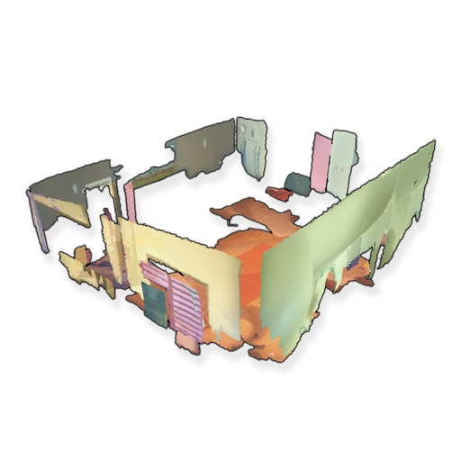
The application allows you to work with the LiDAR sensor, built-in into the iPad Pro 11 (2nd generation), iPad pro 12.9 (4th generation), iPhone 12 Pro. Scan surroundings and analyse it into LidarCad: measure various dimensions such as width, height, length, area, volume. Also you will be able to perform simple editing with your scans. With this App you can estimate volume and area of various objects: construction, natural relief or cargo - it can be done with ease! Switch between feet and meters measurement units. Results saved into .dwg format. App saves the scan results as a point clouds or meshes. Сlouds can be exported to pts or ply format. Meshes can be classified as wall, ceiling, floor, door, window, table or seat. Classified objects are saved in separate layers into DWG file. Tree detection determines diameter and direction of tree trunk. The minimal diameter is 5 cm., maximum is about 5 m. With this function it is possible to capture pipes, poles or columns. The measurements accuracy made with LiDAR sensor depends on the accuracy of the accelerometer and gyroscope. Errors accumulate while iPad camera moves. According to our observations, it is about 1.5% of the measured line length and 2% and 3% for area and volume respectively. App contains 2D drawing tools, in each step you could edit new entities with precision. Auto entity analyzes the drawing path and can recognize a segment as: * Polyline * Arc * Circle Also, you can use tools, that draw certain type of entity: * Polyline * Circle * Multiline * Text, MText * Table entities * Hatch with patterns * Cloud, Marker for markups Edit your drawings with snap and grip points just like on computer. Also you can set length/angle values to entities - this tools uses a parametric engine, specially designed for touch screens. Edit your drawing with a set of frequently used CAD tools: * Move, Copy, Scale, Rotate * Undo, Redo * Offset, Mirror * Join, Explode * Send-To-Back, Bring-To-Front * Entity Filter Tool Measuring tools contains: * Distance measurement (supports 2D and 3D) * Area measurement * Ortho measurement tool * Position tool (2D and 3D modes) You could connect your rangefinder to this App. It supports: * Bosch GLM50C, GLM100C, GLM120C * Bosch PLR30C, PLR40C, PLR50C * Leica DISTO D110, D1, D2 * Leica DISTO D510, D810, S910 * Leica DISTO X3, D8 * Condtrol Vector Also you could use layers, layouts, views, color management in this App. Plot drawing to pdf/jpeg images, or directly to AirPrint device. You can work with drawings from any source: iCloud, Dropbox, Google Drive, Box, email, or use internal storage. Share drawings by email, Files or other App.

LidarCad
View in App StoreGrow your in-app revenue
while we take care of your subscription management.
Mobile
SDK by Qonversion.
Price Intelligence based on:
213,534
apps aggregated
8,172,290
in-app prices defined
89
main categories
In-App Purchase Price (Subscription or Non-Recurring)
vs. average for the Productivity category, $, by region
Build, analyze, and grow in-app subscriptions
with the most powerful mobile SDK for subscriptions
User Reviews for LidarCad
Great updates
I can now apply field codes to points as I create them. Several survey applications where this level of accuracy is acceptable. Great tool. Thank you for the amazing app!
Good
I use this app to view drawings.
Great tool for underground mining and construction!
Love this app, use it all time at the underground mine I work at. I was able to scan 300 ft of tunnel and match it with a survey scan. Perfect for scanning cross sections for ventilation stations and measuring distances. I can easily use the data in Maptek Point Studio and Trimble business center. Only complaint is that I can not export my scans as a las file I have to convert the pts file in Trimble in order to use it in Point Studio. So 6 ****** stars if you can add a las as export option.
Not working
Apple Pencil (2nd generation) doesn’t work in the app. I could not draw straight shapes. Appears extremely clunky & disfunctional. Why did I pay $17.99 for this?
Description
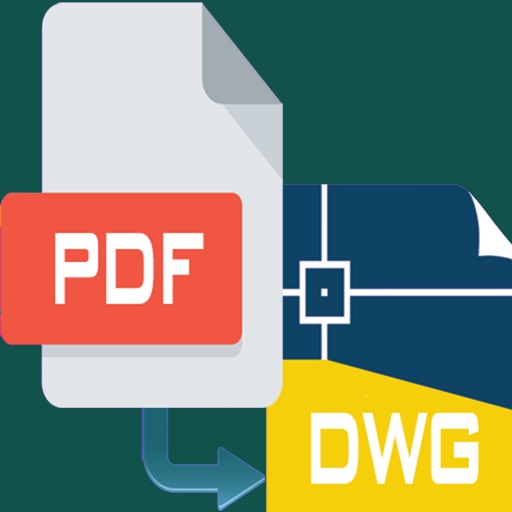
This app supports DWG and DXF files. LidarCad designed for mobile devices and contains tools, that increase your productivity on touch screens. We trying to make designing fast, like on the desktop, and mobile - to work in the field.
You May Also Like


POWER SUBSCRIPTION REVENUE GROWTH
